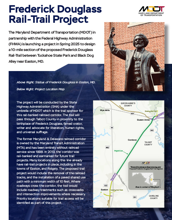
The Frederick Douglass Rail Trail (FDRT) will repurpose the former Pennsylvania Railroad and Maryland & Delaware Railroad tracks as a 10-foot wide shared use path connecting the Town of Easton with the Town of Queen Anne. The plan is that it will connect to Tuckahoe State Park and its network of trails.
On April 3, 2025 MODT made the announcement that the State will be using Federal Carbon Reduction Grant monies to take the next step in the feasibility and design of the trail from Easton to Tuckahoe State Park. [Forward to 4:00 into the video]
About the 2020 MDDE (Maryland & Delaware Railroad Company) Project Assessment (linked below)
“In 2020, a study process was initiated that focused on identifying how the FDRT could spur economic development; improve residents’ health and quality of life by increasing access to community assets such as parks, schools, and businesses; and bring recognition to the African American/Black historical experience, railroad history, and agricultural heritage of Maryland’s Eastern Shore.
The purpose of this assessment was to document the potential for trail development within and adjacent to the rail corridor in Talbot County. This section of the rail corridor is approximately 15 miles long, extending northeast from the Town of Easton to Tuckahoe State Park, and was identified as a priority because of the active support of Talbot County for the rail-trail concept, the potential demand from trail users, and the presence of key destinations. This assessment included an inventory of historic, cultural, recreational, and natural assets along the rail corridor, and identification of physical, environmental, design and management issues and opportunities that will inform development of a trail feasibility study in the future.”
The following partners formed the core planning team to help guide the rail-trail study process:
- Maryland Park Service, Maryland Department of Natural Resources
- Talbot County Departments of Parks & Recreation, Planning and Zoning and Economic Development
- Eastern Shore Land Conservancy
- National Parks Service
- Maryland Office of Tourism
Download the MDDE Rail Corridor and Trail Assessment (2020 Study)
In Summary
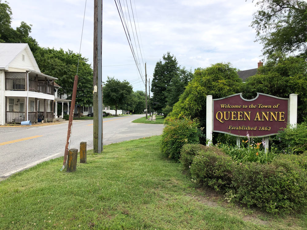
The proposed route begins just north of the town of Queen Anne, in Queen Anne’s County and ends at the former rail line intersection with Black Dog Alley just north of Easton in Talbot County, Maryland. The total project length is approximately 9.5 miles. Trailhead amenities are planned within the towns of Queen Anne and Cordova. The proposed trail surface is a four-inch thickness of graded aggregate base underneath a two-inch asphalt concrete base course and two-inch asphalt concrete surface course. One-foot wide grass shoulders are proposed along both sides of the trail, except on bridge approaches.
The proposed trail uses the existing railway alignment over most of the project length. The railway is within a continuous 65-foot wide right of way, based off GIS property lines, which the State still controls. One proposed deviation from the railway route is a 1.3-mile realignment that avoids bisecting the 192-acre farm owned by Harry and Sharon Eaton while providing a direct connection to the Frederick Douglass Park on the Tuckahoe, a master-planned park through Talbot County Parks and Recreation. The County has completed a plan for that Park which includes work in three stages, with a trail along the frontage of the property as part of the first stage.
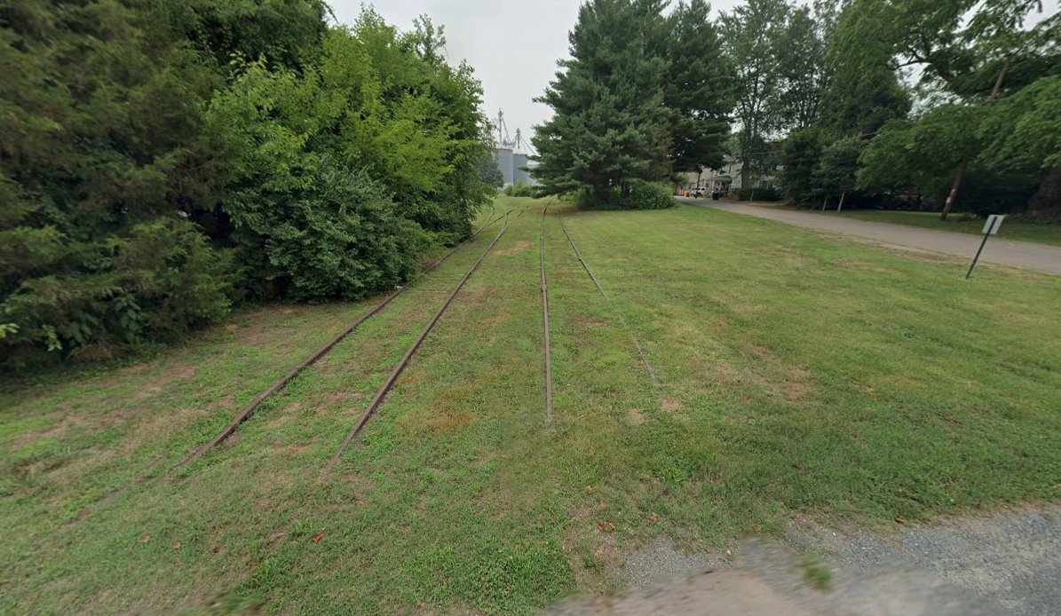
The rail line is well-maintained within the town centers of Queen Anne and Cordova, as well as along the frontage of many of the commercial and industrial facilities within the project limits. Trees, weeds, and shrubs currently grow over most of the existing tracks.
The FDRT was added to the priority list for the County which was ratified by the Council in March of 2024 and submitted to the MD Department of Transportation stating “Frederick Douglass Recreational Trail from the Town of Easton to the Town of Queen Anne: Talbot County has been working with the Maryland Department of Transportation agencies, Maryland Department of Natural Resources and other State and local stakeholders on preliminary planning for the Frederick Douglass Recreational Trail. This effort has been underway for many years. The alignment of this alternative transportation/recreational trail is the former Pennsylvania Railroad and Maryland & Delaware Railroad rights-of-way from the Town of Easton to the Town of Queen Anne. Talbot County seeks continued support for this project including funding for the design and construction of this beneficial alternative transportation and recreational facility.”
Talbot Thrive, as part of the Talbot County Bike & Pedestrian Advisory Committee will help guide State entities and the Council on this project. The advisory committee has representatives from all parties who wish to make their position known and are willing to work on developing a Master Plan for the County on Bike & Pedestrian facilities including this and future trail projects.
Talbot County Council held a Work Session on Bike & Pedestrian Plans in Talbot County and the FDRT on July 9, 2024
- Download Talbot Thrive’s Presentation to the County Council here
- To stay up to date with future meetings and agendas, visit https://www.talbotcountymd.gov/About-Us/County_Council/council-meeting-videos
- To add your name to Talbot Thrive’s enewsletter list, click below:
Frequently Asked Questions – Addressing Local Concerns
Un sentiero non danneggia il valore della mia proprietà?
Gli studi condotti dopo che i sentieri sono stati operativi per un certo numero di anni, riportano costantemente che essi (i sentieri) sono stati migliori vicini di quanto gli scettici si aspettassero. Quando vengono valutati rispetto allo status quo, alcuni percepiscono un sentiero riadattato come una passività che potrebbe ridurre la loro qualità di vita. Tuttavia, con il passare del tempo è probabile che si verifichino due scenari che fanno svanire il negativismo. In primo luogo, l'esperienza con la pista rassicura i residenti vicini che i loro timori erano infondati o sopravvalutati. In secondo luogo, dato che la vicinanza a un sentiero è relativamente scarsa in molte comunità urbane, coloro che lo considerano un'attrattiva desiderabile probabilmente pagheranno un premio per le proprietà quando saranno messe in vendita. (Compton, 2019)
Articoli e studi
- L'impatto delle greenways sul valore degli immobili
- Vendita case vicino a Two Massachusetts Rail Trails
- Scelte pubbliche e valore della proprietà
- Piste ciclabili: sicurezza e valore della proprietà
- La pista ciclabile Mohawk-Hudson - Il suo impatto sulle proprietà residenziali adiacenti
- L'impatto del sentiero panoramico di Little Miami sul valore degli immobili residenziali unifamiliari
- Impatto dei percorsi ferroviari sul valore degli immobili- Un caso di studio della Minuteman Bikeway
- Sentieri ricreativi di Omaha: il loro effetto sul valore delle proprietà e sulla sicurezza pubblica
- Sintesi dello studio sull'impatto comunitario del sentiero della contea di Pinellas
Come può un sentiero ad uso condiviso funzionare in modo sicuro all'interno di un'area agricola attiva?
I sentieri e le aree agricole attive possono convivere in armonia, come dimostrano esempi provenienti da tutti gli Stati Uniti, che comprendono un'ampia gamma di livelli di utilizzo, superfici dei sentieri e politiche di gestione. Le seguenti strategie sono state essenziali per il successo dei sentieri nelle aree agricole:
- Recinzioni naturali e fisiche per delimitare chiaramente i sentieri e le aree agricole e fornire barriere.
- Agli agricoltori viene data la possibilità di inserire notifiche sul sentiero quando le operazioni agricole sarebbero altrimenti limitate o pericolose per gli utenti del sentiero.
- Attraversamenti controllati che consentano alle attrezzature agricole di raggiungere entrambi i lati del sentiero, ove necessario.
- Segnaletica per avvisare gli utenti del sentiero della presenza di operazioni agricole attive e per istruirli a rimanere sul sentiero (poiché il sentiero continuerà ad essere di proprietà dello Stato, i proprietari terrieri le cui proprietà confinano con il sentiero non sono responsabili delle attività di coloro che lasciano la proprietà dello Stato e sconfinano in terreni di proprietà privata)
- Creare gruppi o club di difesa per garantire la manutenzione e l'osservazione del sentiero per ridurre al minimo gli atti di vandalismo e incoraggiare un ambiente di autocontrollo.
Articoli:
Un sentiero non porterà criminalità e senzatetto nella mia proprietà?
Numerosi studi hanno dimostrato che lo sviluppo di progetti ferroviari non comporta un aumento della criminalità. La National Rails to Trails Coalition ha studiato l'impatto di tre grandi progetti ferroviari nel 1996 e ha scoperto che l'incidenza dei crimini sui sentieri era molto bassa rispetto al tasso di criminalità generale. I loro studio di sentieri rurali conclusi:
- Si stima che ci siano 26 milioni di utenti annuali sui 254 sentieri rurali censiti che coprono 5.282 miglia.
- Il tasso nazionale di scippi nelle aree rurali è di 19 per 100.000 abitanti; nessuno dei sentieri ferroviari rurali ha riportato scippi nel 1995 e solo uno ha riportato un incidente nel 1996.
- Il tasso nazionale di aggressioni aggravate nelle zone rurali è di 203 incidenti ogni 100.000 persone; solo tre percorsi ferroviari rurali hanno riportato tre aggressioni nel 1995 e lo stesso numero nel 1996.
- A livello nazionale, ci sono stati 26 stupri forzati ogni 100.000 abitanti delle zone rurali; due strade ferrate rurali hanno denunciato uno stupro nel 1995 e un sentiero nel 1996.
- Il tasso nazionale di omicidi nelle aree rurali è di 5 su 100.000; nessuno dei percorsi ferroviari rurali ha registrato un omicidio nel periodo di due anni.
Articoli e studi
- Percorsi ferroviari e comunità sicure
- Effetti dei sentieri su quartieri, valore delle case, sicurezza e qualità della vita
- I vicini di casa vicini alle piste ciclabili dovrebbero preoccuparsi della criminalità?
- Valutazione dell'effetto del Burke-Gilman Trail sui valori immobiliari e sulla criminalità
- La pista ciclabile Mohawk-Hudson - Il suo impatto sulle proprietà residenziali adiacenti
Come possono le attività di caccia coesistere in modo sicuro con un sentiero ad uso condiviso nelle vicinanze?
Negli Stati Uniti ci sono più di 22.000 miglia di sentieri ferroviari e, come si può immaginare, molti di essi attraversano zone rurali dove la caccia è una parte importante della comunità. I gestori dei sentieri (alcuni potrebbero essere sovrintendenti di foreste statali o nazionali) hanno fornito diverse soluzioni ai conflitti che possono sorgere sui sentieri a causa della caccia. In effetti, le prove storiche della compatibilità tra sentieri e caccia sono profondamente radicate nei percorsi escursionistici a singolo binario come l'Appalachian Trail. Uno dei più antichi sentieri ferroviari della nazione, lo Stony Creek Railroad Grade, lungo 20 miglia, nella contea di Dauphin (PA), attraversa oltre 40.000 acri di terreni di caccia statali ed è in funzione dal 1943 senza che si siano verificati incidenti.
Alcuni esempi di altri sentieri ferroviari che sono stati realizzati in prossimità o attraverso terreni di caccia pubblici e privati e che hanno accolto con successo gli utenti dei sentieri e i cacciatori.
Articoli
- Clarion, PA - La ferrovia di Little Toby Creek e la ferrovia di West Penn (Il Clarion-Little Toby Creek Trail e il West Penn Trail richiedono che gli utenti dei sentieri indossino una tuta arancione durante la stagione della caccia).
- Area faunistica di Springvalley (Xenia, OH) Una pista ciclabile multiuso si snoda lungo una delle paludi più cacciate dello Stato. Karen Kelley, direttrice del Marion County Park District, riconosce l'importanza della pista per la conservazione dell'habitat della fauna selvatica, "Il nostro distretto del parco cercherà di mostrare attraverso il railtrail le paludi e le praterie di alto fusto in stagione per sostenere gli sforzi di conservazione e mantenimento dell'habitat della fauna selvatica".
- Buffer di divieto di caccia: Alcuni sentieri che attraversano terreni di caccia pubblici e privati prevedono un "cuscinetto di divieto di caccia". (Amherst, MA) È vietato portare armi da fuoco cariche entro 150 piedi dal sentiero, il che corrisponde alla legge statale del Massachusetts sulla caccia in prossimità di strade asfaltate. Tuttavia, i cacciatori utilizzano spesso la ferrovia per andare e tornare dai luoghi di caccia.
- Via verde della valle del Genesee
(New York occidentale) Su questo sentiero multiuso di 90 miglia, i cacciatori possono utilizzare il sentiero per accedere ai luoghi di caccia, ma non possono sparare da o attraverso il sentiero. Il sentiero non è chiuso durante la stagione di caccia e uno dei proprietari terrieri adiacenti è un club di caccia. - Sintesi dei regolamenti di caccia del Maryland
- Il Guida completa alla caccia e alla pesca nel Maryland Stati:
- È illegale sparare al bersaglio sui terreni statali, tranne che nelle aree designate. (I sentieri ferroviari sono terreni statali)
- È illegale cacciare, sparare o catturare animali selvatici entro 150 metri da qualsiasi edificio o campo occupato da esseri umani senza il permesso del proprietario o dell'occupante.
La mia proprietà è adiacente al corridoio ferroviario. In che modo posso trarre vantaggio dal percorso ferroviario e in che modo il percorso fornirà sviluppo economico a quest'area?
Il modo in cui i proprietari terrieri lungo il corridoio ferroviario trarranno vantaggio dal percorso ferroviario attraverso le opportunità commerciali dipende da loro e dalla loro imprenditorialità. I funzionari dello sviluppo economico della contea di Talbot lavoreranno attivamente con coloro che esprimono interesse per un'iniziativa imprenditoriale, al fine di massimizzare tale opportunità e il suo successo. Inoltre, i funzionari della contea addetti alla pianificazione e alla zonizzazione si impegnano a garantire la giusta zonizzazione lungo il corridoio ferroviario per supportare qualsiasi proposta commerciale che si presenti. L'agriturismo e i sentieri in generale possono essere un importante motore economico per l'intera area, soprattutto con l'aumento dei visitatori previsto dal Frederick Douglass Park sul fiume Tuckahoe.
Articoli e studi
- Portare affari: Una guida per attirare i cicloturisti nelle comunità dei canali di New York
- Il Parco storico nazionale del C&O Canal è un motore economico per le comunità circostanti
- Trasformare i corridoi ferroviari in motori economici
- Impatto economico del sentiero ferroviario di Shanendoah
"La riconversione dei vecchi tracciati ferroviari in vivaci sistemi di sentieri richiede pianificazione, impegno della comunità, partnership collaborative e buone pratiche innovative, unite all'attenzione per l'equità e l'inclusione. I risultati sono sistemi ferroviari che offrono una varietà di opzioni abitative a prezzi accessibili, promuovono opportunità economiche e di trasporto e migliorano la qualità della vita di tutti i residenti".

