First Steps
In late 2023, the Town of Oxford was approved for a Kim Lamphier Bikeways Grant for the initial feasibility and design of the first step of the proposed Oyster Trail – the Oxford Parks Connector Trail.
The grant is for a proposed shared-use recreational trail that will connect two parks in the Town of Oxford, MD with two adjacent County-owned parks. The project also includes study of installation of a bicycle service area. Ultimately, this project lays the foundation for creating an off-road route for people and families who ride bikes to enjoy the outdoors, especially the existing Oxford Conservation Park, and also supports the establishment of Oxford, MD as a terminus point in the future vision for a bicycle/pedestrian rail trail that connects Oxford to the Town of Easton. In alignment with our Comprehensive Plan and our Sustainable Community Plan, the Town of Oxford has been working with Talbot Thrive to improve the connectivity of our town parks and the County’s Oxford Conservation Park by developing a safe, accessible multi-use trail.
Who Was Kim Lamphier?
Kim Lamphier was a tireless supporter for safe, bicycle access across Maryland.
Over the years, Kim worked on issues relating to small businesses, bicycle safety, wildlife protection, criminal justice reform and promoting youth participation in government. She worked on the campaigns of some of Maryland’s luminary political figures at all levels of government. In her last year, 2019, in her roles with Trash Free Maryland and Bike Maryland, she was the principal advocate for two major legislative victories – the first statewide Styrofoam ban in the country and a bill that guarantees funding for Maryland’s Bikeways Network program. She worked to secure these victories, even as she was recovering from three months of intensive chemotherapy treatment and post-surgery physical therapy. She was an indomitable force.
In 2020, the Maryland General Assembly voted to rename the MDOT Bikeways Program in Kim’s honor.
The Dream: A Trail from Oxford to Easton – The Oyster Trail
Imaginez que l'ancienne servitude ferroviaire du Maryland et du Delaware, qui relie Easton à Oxford, soit transformée en piste piétonne et cyclable. Un membre du conseil d'administration a récemment découvert que cette voie est partiellement visible à plusieurs endroits le long d'Oxford Road et qu'elle a été partiellement entretenue par des propriétaires privés depuis la fermeture de la ligne de chemin de fer en 1996. Un parc/sentier linéaire pourrait servir à relier les équipements commerciaux, historiques et culturels le long d'un sentier à usage partagé accueillant les marcheurs, les joggeurs et les cyclistes de tous âges et de tous niveaux de condition physique.
Achevé après la guerre de Sécession, l'embranchement d'Oxford était un élément clé de l'infrastructure qui a conduit à la prospérité de la région de l'Eastern Shore Tidewater. La servitude de 66 pieds de large a été abandonnée au milieu des années 1960 et le terrain a été cédé aux propriétaires des terrains adjacents. Le défi consistera à trouver un moyen de récupérer l'accès à une partie de l'ancienne servitude et les recherches préliminaires ont indiqué que cela sera difficile, mais pas insurmontable. Le Rails to Trails Conservancy de Washington DC a été d'une grande aide pour de nombreux autres groupes qui ont mené à bien des projets similaires dans d'autres endroits. Il existe plus de 2 000 exemples de projets de chemins de fer réussis dans les 50 États, et donc de nombreux bons précédents à suivre. Le projet de loi sur les infrastructures récemment adopté prévoit un financement substantiel pour des projets de transport actif tels que celui-ci.
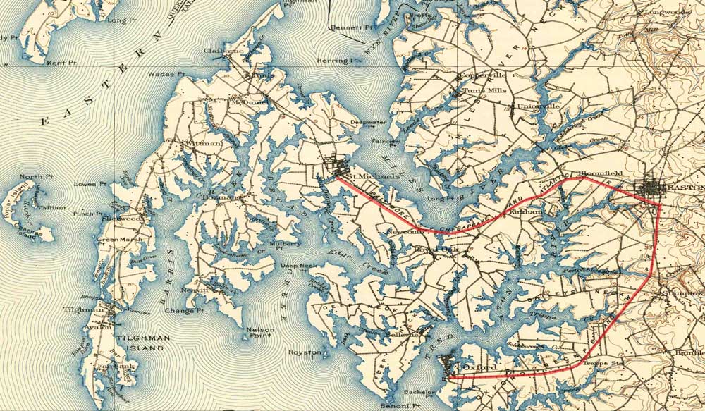
Imaginez que, dans un avenir proche, il soit possible de parcourir l'ensemble de l'itinéraire de 8 miles entre Oxford et Easton sur une voie verte boisée, sûre et magnifique, qui contribuerait à soutenir les entreprises locales et à attirer les piétons et les cyclistes vers un aménagement sain et sûr pour les visiteurs et les habitants du comté de Talbot.
Merci au membre du conseil d'administration Cameron J. Mactavish d'Oxford MD
Le rêve...
CONVERTIR LE CHEMIN DE FER HISTORIQUE D'OXFORD EN UNE PISTE PIÉTONNE ET CYCLABLE
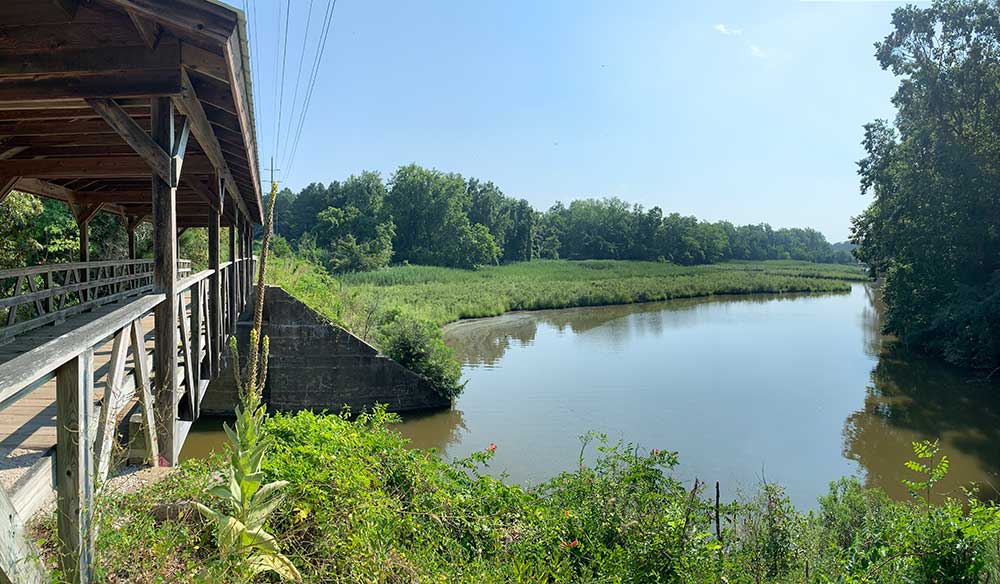
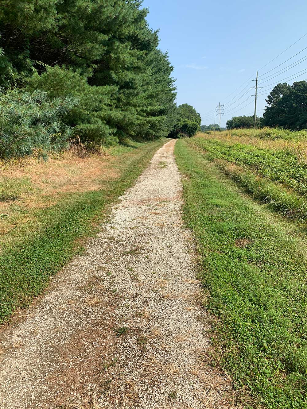
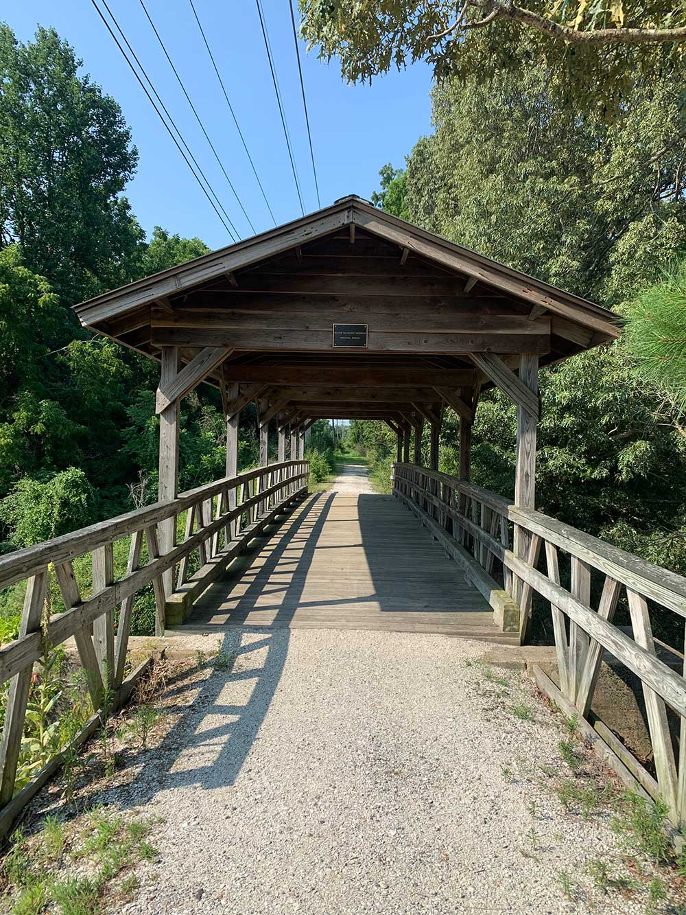
Bien que le dernier train ait circulé avant 1960, de nombreuses portions de l'ancienne voie ferrée d'Oxford et d'Easton existent toujours et sont encore praticables à pied aujourd'hui.
LA SANTÉ ET LA SÉCURITÉ DES RÉSIDENTS ET DES VISITEURS
Une voie réservée aux piétons et aux cyclistes améliorera la santé et la sécurité des habitants du comté de Talbot et des visiteurs en leur permettant de quitter l'accotement.
de la route d'Oxford, de plus en plus fréquentée
BOOM POUR LES ENTREPRISES LOCALES
L'augmentation du trafic piétonnier et cycliste permettra aux entreprises locales de mieux prospérer tout au long de l'année. Plus de 2 000 projets de voies ferrées ont été réalisés dans les 50 États et l'impact économique positif des projets de voies ferrées est bien documenté.
SE CONNECTER À LA PISTE CYCLABLE POTENTIELLE DU ST. MICHAEL'S RD BIKE PATH
La conversion de cette section et la création d'une liaison avec la piste cyclable d'Easton permettront de créer une "boucle de l'huître" de 25 miles reliant Oxford, Easton et St Michael's et s'étendant jusqu'à McDaniel. Le ferry d'Oxford pourra alors être utilisé pour compléter la boucle.
Questions fréquemment posées
La présence d'un sentier ne va-t-elle pas nuire à la valeur de ma propriété ?
Des études réalisées après que les sentiers aient été opérationnels pendant un certain nombre d'années, ont constamment rapporté qu'ils (les sentiers) étaient de meilleurs voisins que les sceptiques ne l'avaient prévu. Lorsqu'ils sont évalués par rapport à la référence du statu quo, certains perçoivent un sentier réaménagé comme un handicap susceptible de réduire leur qualité de vie. Cependant, avec le temps, deux scénarios sont susceptibles d'émerger et de dissiper le négativisme. Tout d'abord, l'expérience du sentier rassure les riverains, qui se rendent compte que leurs craintes étaient infondées ou exagérées. Deuxièmement, comme la proximité d'un sentier est relativement rare dans de nombreuses communautés urbaines, ceux qui considèrent qu'il s'agit d'une commodité souhaitable sont susceptibles de payer une prime pour les propriétés lorsqu'elles sont mises en vente. (Compton, 2019)
Articles et études
- L'impact des voies vertes sur la valeur des propriétés
- Ventes de maisons près de Two Massachusetts Rail Trails
- Choix publics et valeur de la propriété
- Pistes cyclables - Sécurité et valeur des biens immobiliers
- La piste cyclable Mohawk-Hudson - son impact sur les propriétés résidentielles adjacentes
- L'impact du sentier panoramique du Petit Miami sur la valeur des propriétés résidentielles unifamiliales
- Impact des voies ferrées sur la valeur des biens immobiliers- Une étude de cas de la piste cyclable Minuteman
- Les sentiers récréatifs d'Omaha - leur effet sur la valeur des propriétés et la sécurité publique
- Résumé de l'étude d'impact communautaire du sentier du comté de Pinellas
Comment un sentier à usage partagé peut-il fonctionner en toute sécurité dans une zone agricole active ?
Les sentiers et les zones agricoles actives peuvent exister en harmonie, comme le démontrent des exemples provenant de tous les États-Unis, y compris un large éventail de niveaux d'utilisation, de surfaces de sentiers et de politiques de gestion. Les stratégies suivantes ont été essentielles au succès des sentiers dans les zones agricoles :
- Clôtures naturelles et physiques pour délimiter clairement les sentiers et les zones agricoles et créer des barrières.
- Les agriculteurs ont la possibilité de placer des avis sur le sentier lorsque les activités agricoles sont limitées ou dangereuses pour les utilisateurs du sentier.
- Des croisements contrôlés qui permettent au matériel agricole d'atteindre les deux côtés du sentier, le cas échéant.
- Signalisation pour avertir les utilisateurs du sentier de la présence d'exploitations agricoles en activité et leur demander de rester sur le sentier (étant donné que le sentier restera la propriété de l'État, les propriétaires fonciers dont les terrains jouxtent le sentier ne sont pas responsables des activités de ceux qui quittent la propriété de l'État et pénètrent sur des terrains privés).
- Créer des groupes de pression ou des clubs pour assurer l'entretien et l'observation du sentier afin de minimiser le vandalisme et d'encourager un environnement d'autosurveillance.
Articles :
Un sentier ne risque-t-il pas d'attirer la criminalité et les sans-abri sur ma propriété ?
De nombreuses études ont montré que le développement de projets de voies ferrées ne s'accompagne pas d'une augmentation de la criminalité. La National Rails to Trails Coalition a étudié l'impact de trois grands projets de voies ferrées en 1996 et a constaté que l'incidence des délits sur les voies ferrées était très faible par rapport aux taux de criminalité globaux. Les résultats de cette étude sont les suivants étude des sentiers ruraux a été conclu :
- On estime à 26 millions le nombre d'utilisateurs annuels des 254 sentiers ruraux recensés, qui couvrent 5 282 miles.
- Le taux national d'agressions dans les zones rurales est de 19 pour 100 000 habitants ; aucune des pistes ferroviaires rurales n'a signalé d'agressions en 1995 et une seule en 1996.
- Le taux national d'agressions aggravées en milieu rural est de 203 incidents pour 100 000 personnes ; seules trois pistes ferroviaires rurales ont signalé trois agressions en 1995 et le même nombre en 1996.
- Au niveau national, il y a eu 26 viols pour 100 000 habitants en milieu rural ; deux chemins de fer ruraux ont signalé des viols en 1995 et un chemin a signalé un viol en 1996.
- Le taux national d'homicides dans les zones rurales est de 5 pour 100 000 ; aucun des sentiers ferroviaires ruraux n'a signalé d'homicide au cours de la période de deux ans.
Articles et études
- Chemins de fer et communautés sûres
- Effets des sentiers sur les quartiers, la valeur des maisons, la sécurité et la qualité de vie
- Les voisins des pistes cyclables doivent-ils s'inquiéter de la criminalité ?
- Évaluation de l'effet de la piste Burke-Gilman sur les valeurs immobilières et la criminalité
- La piste cyclable Mohawk-Hudson - son impact sur les propriétés résidentielles adjacentes
Comment les activités de chasse peuvent-elles coexister en toute sécurité avec un sentier à usage partagé à proximité ?
Les États-Unis comptent plus de 22 000 miles de chemins de fer et, comme vous pouvez l'imaginer, nombre d'entre eux traversent des zones rurales où la chasse est un élément important de la communauté. Les gestionnaires de sentiers (certains peuvent être des surintendants des forêts nationales ou d'État) ont apporté différentes solutions aux conflits qui peuvent survenir sur les sentiers en raison de la chasse. En fait, les preuves historiques de la compatibilité entre les sentiers et la chasse sont profondément enracinées dans les sentiers de randonnée à voie unique comme le sentier des Appalaches. L'une des plus anciennes voies ferrées du pays, le Stony Creek Railroad Grade, d'une longueur de 20 miles, dans le comté de Dauphin, en Pennsylvanie, traverse plus de 40 000 acres de terres de chasse de l'État et est en service depuis 1943 sans qu'aucun blessé ne soit à déplorer.
Quelques exemples d'autres sentiers ferroviaires qui ont été établis à côté ou à travers des terrains de chasse publics et privés et qui ont accueilli avec succès les utilisateurs du sentier et les chasseurs.
Articles
- Clarion, PA - Little Toby Creek Rail-Trail et West Penn Rail-Trail (Le Clarion-Little Toby Creek Trail et le West Penn Trail exigent que les utilisateurs du sentier portent des vêtements orange pendant la saison de la chasse).
- Springvalley Wildlife Area (Xenia, OH) Une piste cyclable polyvalente longe l'un des marais les plus chassés de l'État. Karen Kelley, directrice du Marion County Park District, reconnaît l'importance de la piste pour la préservation de l'habitat de la faune et de la flore, "Notre district des parcs va essayer de mettre en valeur, grâce au railtrail, les marais et les prairies d'herbes hautes en saison, afin de soutenir les efforts de préservation et de maintien de l'habitat de la faune sauvage.
- Zone tampon de non-chasse : Certains sentiers qui traversent des terrains de chasse publics et privés imposent une "zone tampon de non-chasse" (Amherst, MA) Le port d'armes à feu chargées est interdit à moins de 150 pieds de la piste, ce qui correspond à la loi de l'État du Massachusetts concernant la chasse à proximité des routes pavées. Cependant, les chasseurs utilisent souvent la voie ferrée pour se rendre sur les lieux de chasse et en revenir.
- Voie verte de la vallée du Genesee
(Ouest de l'État de New York) Sur cette piste polyvalente de 90 miles, les chasseurs sont autorisés à utiliser la piste pour accéder aux lieux de chasse, mais ne peuvent pas tirer depuis ou à travers la piste. La piste n'est pas fermée pendant la saison de chasse et l'un des propriétaires fonciers adjacents est un club de chasse. - Résumé de la réglementation de la chasse dans le Maryland
- Le Guide complet de la chasse et de la pêche dans le Maryland États :
- Il est illégal de pratiquer le tir sur cible sur les terres de l'État, sauf dans les zones désignées. (Les voies ferrées sont des terres domaniales)
- Il est illégal de chasser, de tirer ou de piéger des animaux sauvages à moins de 150 mètres d'un bâtiment ou d'un camp occupé par des êtres humains sans l'autorisation du propriétaire ou de l'occupant.
Ma propriété est située à proximité du corridor ferroviaire. Comment puis-je bénéficier du sentier ferroviaire et comment le sentier contribuera-t-il au développement économique de cette région ?
C'est à eux et à leur esprit d'entreprise qu'il appartient de déterminer comment les propriétaires fonciers situés le long du corridor ferroviaire peuvent tirer parti de la piste ferroviaire en créant des opportunités commerciales. Les responsables du développement économique du comté de Talbot travailleront activement avec ceux qui expriment un intérêt pour une entreprise commerciale afin de maximiser cette opportunité et leur succès. Par ailleurs, les responsables de la planification et du zonage du comté s'engagent à veiller à ce que le bon zonage soit en place le long du corridor ferroviaire pour soutenir toute proposition commerciale qui se présente. L'agritourisme et les sentiers en général peuvent constituer un moteur économique majeur pour l'ensemble de la région, en particulier avec l'augmentation du nombre de visiteurs attendue du parc Frederick Douglass sur la rivière Tuckahoe.
Articles et études
- Apporter des affaires : Un guide pour attirer les cyclotouristes dans les communautés des canaux de New York
- Le parc historique national du canal C&O est un moteur économique pour les communautés environnantes
- Transformer les corridors ferroviaires en moteurs économiques
- Impact économique du chemin de fer de Shanendoah
"La reconversion d'anciennes emprises ferroviaires en systèmes de sentiers dynamiques nécessite une planification, un engagement communautaire, des partenariats collaboratifs et des meilleures pratiques innovantes, combinés à une attention particulière à l'équité et à l'inclusion. Les résultats sont des systèmes de voies ferrées qui offrent une variété d'options de logement abordables, favorisent les opportunités économiques et de transport, et améliorent la qualité de vie de tous les résidents".
Les photos ci-dessous proviennent d'une excursion récente à la découverte de l'ancienne voie ferrée le long du corridor d'Oxford. Merci de ne pas empiéter sur une propriété privée.
